


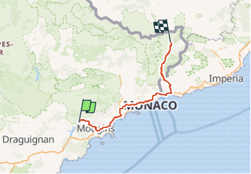
Peymeinade Tende par les gorges de la Roya

jwo47
User

Length
127 km

Max alt
823 m

Uphill gradient
5701 m
Km-Effort
201 km

Min alt
4 m

Downhill gradient
5084 m
Boucle
No
Creation date :
2022-12-31 12:12:07.0
Updated on :
2022-12-31 14:26:00.794
2h12
Difficulty : Unknown

FREE GPS app for hiking
 SityTrail
IGN / Geographical institutes
SityTrail Plus
The world is yours!
About
Trail Car of 127 km to be discovered at Provence-Alpes-Côte d'Azur, Maritime Alps, Peymeinade. This trail is proposed by jwo47.
Description
Route de Peymeinade vers Tende
Positioning
Country:
France
Region :
Provence-Alpes-Côte d'Azur
Department/Province :
Maritime Alps
Municipality :
Peymeinade
Location:
Unknown
Start:(Dec)
Start:(UTM)
327989 ; 4833292 (32T) N.
Comments