


Ballade Auernig

edevuyst
User
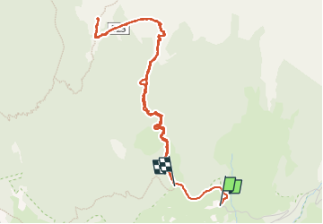

Length
5.3 km

Max alt
2109 m

Uphill gradient
580 m
Km-Effort
12.9 km

Min alt
1519 m

Downhill gradient
524 m
Boucle
No
Creation date :
2023-01-02 10:47:15.0
Updated on :
2023-01-02 14:41:41.989
3h53
Difficulty : Difficult

FREE GPS app for hiking
 SityTrail
IGN / Geographical institutes
SityTrail Plus
The world is yours!
About
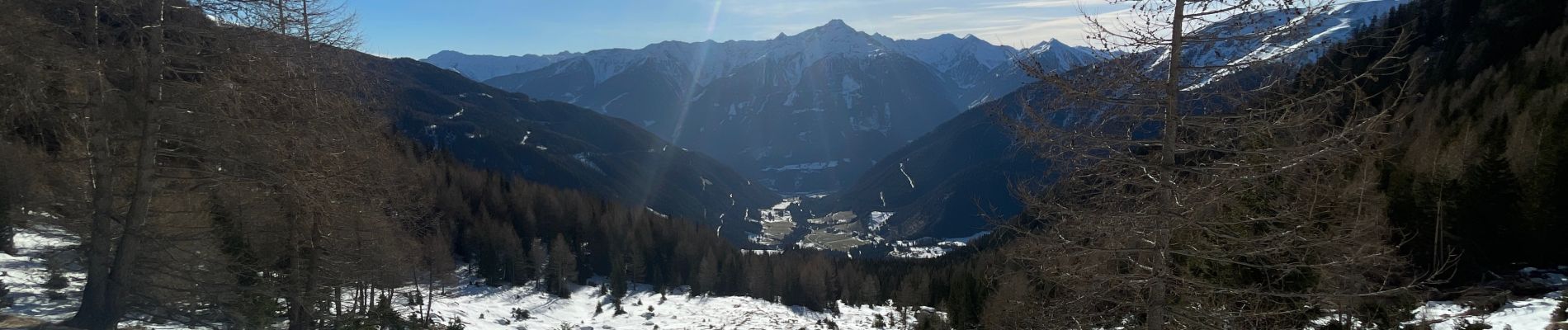
Trail Walking of 5.3 km to be discovered at Carinthia, Bezirk Spittal an der Drau, Mallnitz. This trail is proposed by edevuyst.
Photos


Positioning
Country:
Austria
Region :
Carinthia
Department/Province :
Bezirk Spittal an der Drau
Municipality :
Mallnitz
Location:
Unknown
Start:(Dec)
Start:(UTM)
363125 ; 5204451 (33T) N.
Comments