


boucle Raeren

Lychee
User
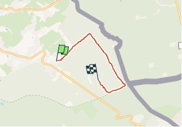

Length
3.7 km

Max alt
390 m

Uphill gradient
55 m
Km-Effort
4.3 km

Min alt
340 m

Downhill gradient
42 m
Boucle
No
Creation date :
2023-01-02 14:09:35.044
Updated on :
2023-01-02 15:40:35.011
1h30
Difficulty : Easy

FREE GPS app for hiking
 SityTrail
IGN / Geographical institutes
SityTrail Plus
The world is yours!
About
Trail Walking of 3.7 km to be discovered at Wallonia, Liège, Raeren. This trail is proposed by Lychee.
Positioning
Country:
Belgium
Region :
Wallonia
Department/Province :
Liège
Municipality :
Raeren
Location:
Raeren
Start:(Dec)
Start:(UTM)
297990 ; 5616683 (32U) N.
Comments