Grotte Balme Rousse
cousam
User
Length
15.7 km
Max alt
862 m
Uphill gradient
1233 m
Km-Effort
32 km
Min alt
199 m
Downhill gradient
1216 m
Boucle
Yes
Creation date :
2023-01-07 08:38:40.375
Updated on :
2023-01-08 17:18:50.732
6h43
Difficulty : Difficult
FREE GPS app for hiking
About
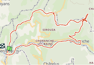
Trail Walking of 15.7 km to be discovered at Auvergne-Rhône-Alpes, Isère, Pont-en-Royans. This trail is proposed by cousam.
Description
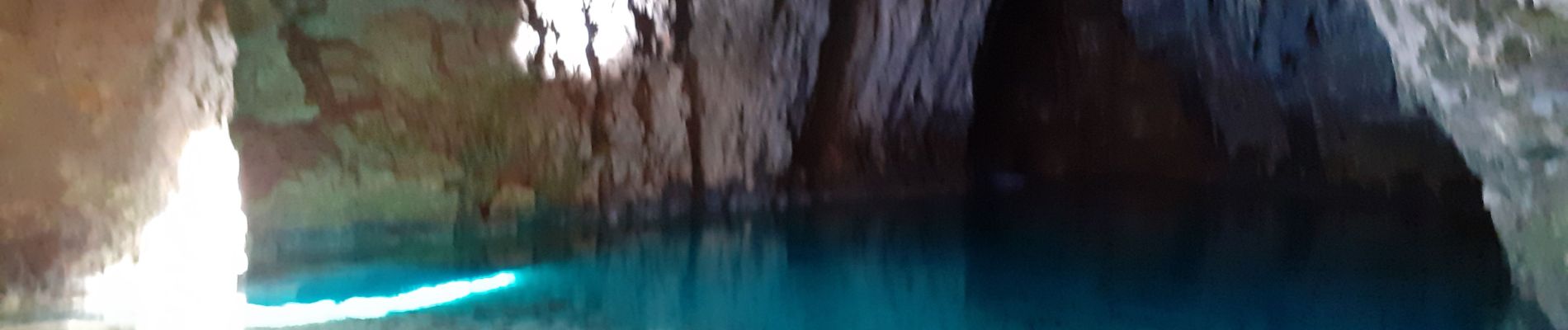
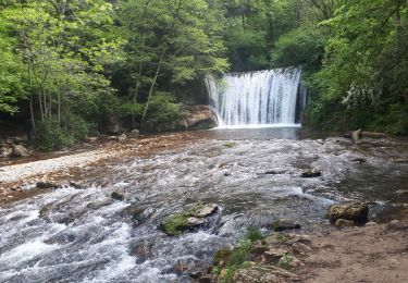
Boucle par la cascade et la grotte Gournier,
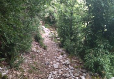
apres la grotte de la Balme rousse, passage avec une corde (attention aux cailloux qui peuvent rouler).
Suivre la falaise ,assez Rock n'Roll ,mais sympa ,jusqu'au KM 10.5
Positioning
Country:
France
Region :
Auvergne-Rhône-Alpes
Department/Province :
Isère
Municipality :
Pont-en-Royans
Location:
Unknown
Start:(Dec)
Start:(UTM)
684500 ; 4992350 (31T) N.
Comments
Trails nearby
Boucle Pas de l'Allier - Pas des Voutes
Walking
Medium
(1)
Châtelus,
Auvergne-Rhône-Alpes,
Isère,
France
10.1 km | 22 km-effort
4h 30min
Yes
La Grotte de Choranche
Walking
Difficult
(1)
Choranche,
Auvergne-Rhône-Alpes,
Isère,
France
17.8 km | 33 km-effort
7h 6min
Yes
Presles - rando amandière - (1)
Walking
Very easy
(1)
Presles,
Auvergne-Rhône-Alpes,
Isère,
France
5.6 km | 7.3 km-effort
1h 39min
Yes
Presles
Mountain bike
Easy
(1)
Presles,
Auvergne-Rhône-Alpes,
Isère,
France
10.4 km | 14.9 km-effort
2h 26min
Yes
26 ste eulalie
Walking
Medium
Sainte-Eulalie-en-Royans,
Auvergne-Rhône-Alpes,
Drôme,
France
14.8 km | 27 km-effort
6h 43min
No
38 pabro charmatte
Walking
Difficult
Châtelus,
Auvergne-Rhône-Alpes,
Isère,
France
11.4 km | 29 km-effort
7h 43min
Yes
Circuit entre Saint-Laurent-en-Royans et Pont-en-Royans
Nordic walking
Medium
Saint-Laurent-en-Royans,
Auvergne-Rhône-Alpes,
Drôme,
France
13 km | 17.4 km-effort
5h 9min
Yes
38 pont en Royans choranche presles
Walking
Difficult
Pont-en-Royans,
Auvergne-Rhône-Alpes,
Isère,
France
15.4 km | 30 km-effort
6h 52min
Yes
Les 3 châteaux 2023
Walking
Medium
Choranche,
Auvergne-Rhône-Alpes,
Isère,
France
3.3 km | 6.3 km-effort
1h 24min
No