


olne

JLBragard
User
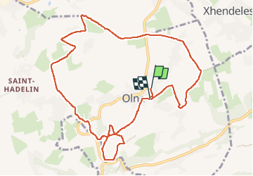

Length
10.7 km

Max alt
275 m

Uphill gradient
250 m
Km-Effort
14.1 km

Min alt
127 m

Downhill gradient
253 m
Boucle
Yes
Creation date :
2022-12-21 12:26:54.353
Updated on :
2023-01-11 20:06:40.811
2h14
Difficulty : Medium

FREE GPS app for hiking
 SityTrail
IGN / Geographical institutes
SityTrail Plus
The world is yours!
About
Trail Walking of 10.7 km to be discovered at Wallonia, Liège, Olne. This trail is proposed by JLBragard.
Positioning
Country:
Belgium
Region :
Wallonia
Department/Province :
Liège
Municipality :
Olne
Location:
Unknown
Start:(Dec)
Start:(UTM)
694814 ; 5608032 (31U) N.
Comments