


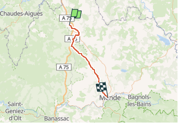
14- St Chély d'Apcher - Mende

v.hanosset
User

Length
49 km

Max alt
1248 m

Uphill gradient
836 m
Km-Effort
61 km

Min alt
710 m

Downhill gradient
1136 m
Boucle
No
Creation date :
2023-01-12 14:44:11.096
Updated on :
2023-02-24 11:02:02.08
3h42
Difficulty : Very difficult

FREE GPS app for hiking
 SityTrail
IGN / Geographical institutes
SityTrail Plus
The world is yours!
About
Trail Road bike of 49 km to be discovered at Occitania, Lozère, Saint-Chély-d'Apcher. This trail is proposed by v.hanosset.
Positioning
Country:
France
Region :
Occitania
Department/Province :
Lozère
Municipality :
Saint-Chély-d'Apcher
Location:
Unknown
Start:(Dec)
Start:(UTM)
521611 ; 4961661 (31T) N.
Comments