


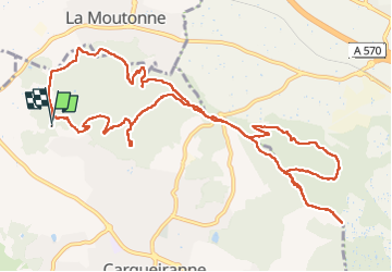

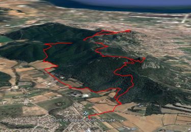
18.1 km | 25 km-effort


User


FREE GPS app for hiking
 SityTrail
IGN / Geographical institutes
SityTrail World
The world is yours!
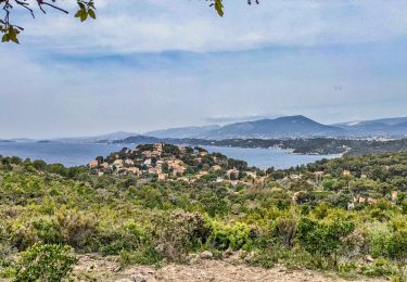
Trail Walking of 14.9 km to be discovered at Provence-Alpes-Côte d'Azur, Var, Carqueiranne. This trail is proposed by Yot.
Beaucoup de montées à l'aller, le retour effectué par des petits chemins très agréables.
Walking

Walking
Walking

Walking

On foot

Cycle
Walking
Walking
Walking