Trail Walking Chantesse - Traversée Chantesse Vitalieu Vinay - Photo

Traversée Chantesse Vitalieu Vinay

© OpenStreetMap contributors
Length
Length
17.7 km
Max alt
Max alt
705 m
Uphill gradient
Uphill gradient
571 m
Km-Effort
Km-Effort  
25 km
Min alt
Min alt
266 m
Downhill gradient
Downhill gradient
604 m
Boucle
Boucle
No
Creation date :
2023-01-12 08:07:17.905
Updated on :
2023-01-13 08:45:50.665

(0 Reviews)

Walking
Walking
6h22
Difficulty : Difficult

Scan this QR Code to open this trail in the SityTrail application

FREE GPS app for hiking

Logo SityTrail SityTrail

IGN / Geographical institutes

Download SityTrail from the App Store Download SityTrail from Google Play

Logo SityTrail SityTrail World

The world is yours!

Download SityTrail from the App Store Download SityTrail from Google Play Download SityTrail on Huawei AppGallery

About

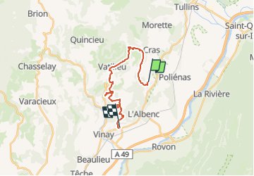
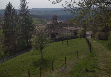
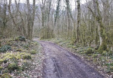
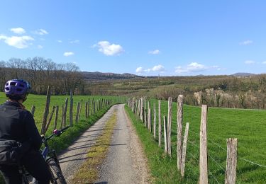
Trail Walking of 17.7 km to be discovered at Auvergne-Rhône-Alpes, Isère, Chantesse. This trail is proposed by GuyVachet.

Description

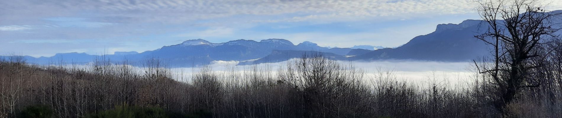
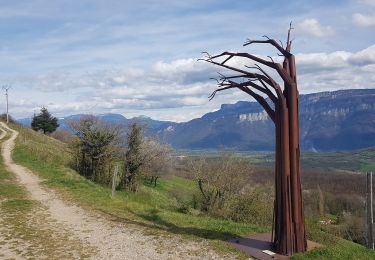
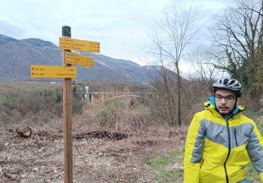
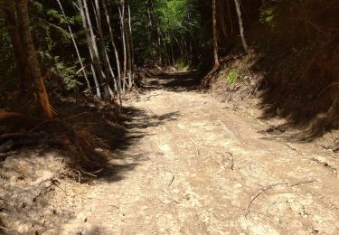
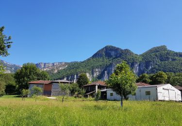
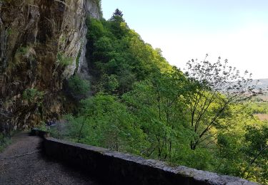
Traversée de Chantesse à Vinay en parcourant les moraines laissées par les temps glaciaires. Le parcours chemine essentiellement entre les plantations de noyer et après une bonne montée parmet d'atteindre le point culminant de l'itinéraire qui offre un très panorama du Vercors à la Chartreuse avec Belledonne qui s'y intercale. Poursuite sur cette crête qui est agrémentée de sculptures avant de passer de moraine en moraine avec une difficulté du passage du ruisseau qui entaille profondément le relief près de la source de Figealore. Un détour par Notre-Dame de l'Osier s'impose avant d'arriver au Musée de la Noix à Vinay.

Elevation profile

Photos

Positioning

Country:
France
Region :
Auvergne-Rhône-Alpes
Department/Province :
Isère
Municipality :
Chantesse
Location:
Unknown
Start:(UTM)
691909 ; 5013140 (31T) N.

Trails nearby

Trail Walking Vatilieu - Les Crêtes de Vatilieu - Photo
Walking
patjobou

Walking

Medium
Vatilieu, Auvergne-Rhône-Alpes, Isère, France
11.5 km | 17.6 km-effort
3h 31min
Yes
Trail Mountain bike Vinay - Vinay-Plaine-Pont de Treillins - Photo
Mountain bike
crocau

Mountain bike

Very easy
Vinay, Auvergne-Rhône-Alpes, Isère, France
10 km | 11.7 km-effort
1h 11min
Yes
Trail Walking Vatilieu - 38 vatilieu - Photo
Walking
himba26100

Walking

Easy
Vatilieu, Auvergne-Rhône-Alpes, Isère, France
11.4 km | 17.4 km-effort
6h 22min
Yes
Trail Walking La Rivière - 38 Versoud passage - Photo
Walking
himba26100

Walking

Medium
La Rivière, Auvergne-Rhône-Alpes, Isère, France
15.5 km | 30 km-effort
4h 32min
No
Trail Walking Rovon - Pied Aigu - Photo
Walking
patjobou

Walking

Difficult
Rovon, Auvergne-Rhône-Alpes, Isère, France
12.4 km | 22 km-effort
5h 19min
Yes
Trail Walking Saint-Gervais - Les Gorges du Gorgonnet par le hameau des Monts - Photo
Walking
patjobou

Walking

Medium
Saint-Gervais, Auvergne-Rhône-Alpes, Isère, France
14.5 km | 21 km-effort
4h 57min
Yes
Trail Mountain bike L'Albenc - autour de l'albenc - vtt - episode 1 - Photo
Mountain bike
popo38

Mountain bike

Easy
L'Albenc, Auvergne-Rhône-Alpes, Isère, France
10.5 km | 14.7 km-effort
56min
Yes
Trail Walking Rovon - Balade autour de Rovon - Photo
Walking
popo38

Walking

Easy
Rovon, Auvergne-Rhône-Alpes, Isère, France
7.2 km | 8.6 km-effort
1h 37min
Yes
Trail Mountain bike Vinay - Vinay-Cognin-Izeron - Photo
Mountain bike
crocau

Mountain bike

Easy
Vinay, Auvergne-Rhône-Alpes, Isère, France
28 km | 33 km-effort
2h 29min
Yes


Close
My subscriptions