


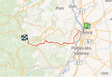
Valence - Vernoux

Shadowfax
User

Length
29 km

Max alt
805 m

Uphill gradient
1147 m
Km-Effort
43 km

Min alt
107 m

Downhill gradient
670 m
Boucle
No
Creation date :
2023-01-13 12:27:32.57
Updated on :
2023-01-13 12:30:28.164
9h43
Difficulty : Very difficult

FREE GPS app for hiking
 SityTrail
IGN / Geographical institutes
SityTrail Plus
The world is yours!
About
Trail Walking of 29 km to be discovered at Auvergne-Rhône-Alpes, Drôme, Valence. This trail is proposed by Shadowfax.
Positioning
Country:
France
Region :
Auvergne-Rhône-Alpes
Department/Province :
Drôme
Municipality :
Valence
Location:
Unknown
Start:(Dec)
Start:(UTM)
648605 ; 4977111 (31T) N.
Comments