


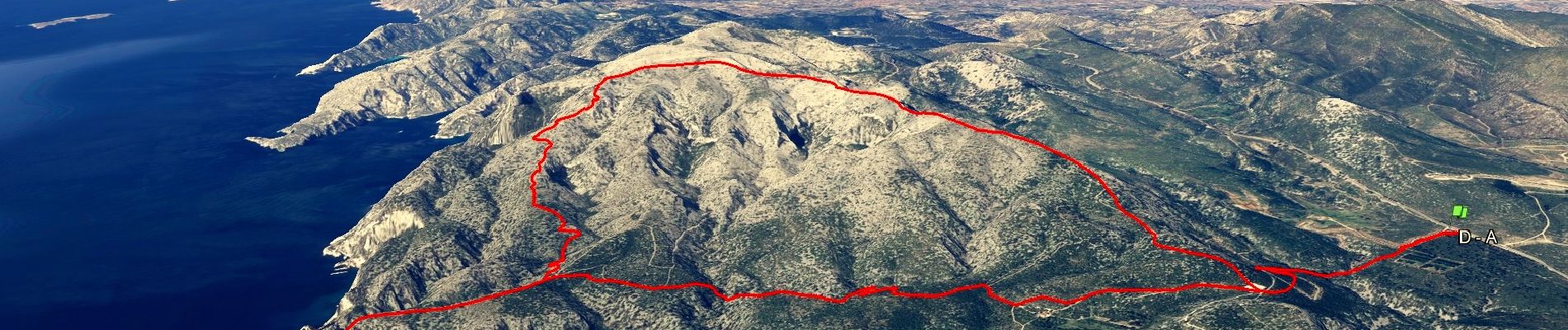
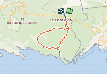
Gardiole - Cap Gros - Crêtes de l'Estret

affinetataille
User GUIDE

Length
13.8 km

Max alt
513 m

Uphill gradient
592 m
Km-Effort
22 km

Min alt
126 m

Downhill gradient
592 m
Boucle
Yes
Creation date :
2023-01-18 08:03:25.093
Updated on :
2023-01-19 08:29:15.858
6h30
Difficulty : Medium

FREE GPS app for hiking
 SityTrail
IGN / Geographical institutes
SityTrail Plus
The world is yours!
About
Trail Walking of 13.8 km to be discovered at Provence-Alpes-Côte d'Azur, Bouches-du-Rhône, Marseille. This trail is proposed by affinetataille.
Photos


25 photos in total. Please click on a photo to see them all in the gallery.
Positioning
Country:
France
Region :
Provence-Alpes-Côte d'Azur
Department/Province :
Bouches-du-Rhône
Municipality :
Marseille
Location:
9th Arrondissement
Start:(Dec)
Start:(UTM)
702980 ; 4790180 (31T) N.
Comments