


Aubel

JLBragard
User
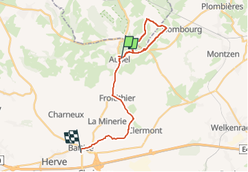

Length
21 km

Max alt
330 m

Uphill gradient
380 m
Km-Effort
26 km

Min alt
186 m

Downhill gradient
279 m
Boucle
No
Creation date :
2023-01-18 12:32:58.245
Updated on :
2023-01-18 16:45:36.114
1h59
Difficulty : Difficult

FREE GPS app for hiking
 SityTrail
IGN / Geographical institutes
SityTrail Plus
The world is yours!
About
Trail Walking of 21 km to be discovered at Wallonia, Liège, Aubel. This trail is proposed by JLBragard.
Positioning
Country:
Belgium
Region :
Wallonia
Department/Province :
Liège
Municipality :
Aubel
Location:
Unknown
Start:(Dec)
Start:(UTM)
701988 ; 5620915 (31U) N.
Comments