


Refuge Chardonnet -> Refuge Bufère par la crête

dewasseigean
User

Length
16.6 km

Max alt
2771 m

Uphill gradient
962 m
Km-Effort
30 km

Min alt
2062 m

Downhill gradient
1119 m
Boucle
No
Creation date :
2023-01-21 09:03:40.79
Updated on :
2023-01-21 09:12:06.82
0m
Difficulty : Very easy

FREE GPS app for hiking
 SityTrail
IGN / Geographical institutes
SityTrail Plus
The world is yours!
About
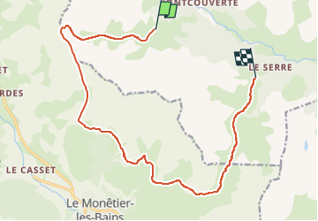
Trail Touring skiing of 16.6 km to be discovered at Provence-Alpes-Côte d'Azur, Hautes-Alpes, Névache. This trail is proposed by dewasseigean.
Description
Long itinéraire par la crête.
Positioning
Country:
France
Region :
Provence-Alpes-Côte d'Azur
Department/Province :
Hautes-Alpes
Municipality :
Névache
Location:
Unknown
Start:(Dec)
Start:(UTM)
305569 ; 4988790 (32T) N.
Comments