


St guihlem

Bwattier
User
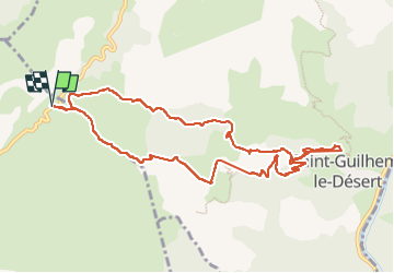

Length
11.4 km

Max alt
560 m

Uphill gradient
585 m
Km-Effort
19.2 km

Min alt
110 m

Downhill gradient
583 m
Boucle
Yes
Creation date :
2022-12-11 08:57:08.339
Updated on :
2023-01-22 15:23:15.725
4h03
Difficulty : Very difficult

FREE GPS app for hiking
 SityTrail
IGN / Geographical institutes
SityTrail Plus
The world is yours!
About
Trail Walking of 11.4 km to be discovered at Occitania, Hérault, Montpeyroux. This trail is proposed by Bwattier.
Positioning
Country:
France
Region :
Occitania
Department/Province :
Hérault
Municipality :
Montpeyroux
Location:
Unknown
Start:(Dec)
Start:(UTM)
540438 ; 4843265 (31T) N.
Comments