


Un tour dans le Jabron

Clo0413
User

Length
16.1 km

Max alt
1093 m

Uphill gradient
622 m
Km-Effort
24 km

Min alt
627 m

Downhill gradient
624 m
Boucle
Yes
Creation date :
2023-01-23 08:09:41.806
Updated on :
2023-01-23 17:25:57.131
4h35
Difficulty : Medium

FREE GPS app for hiking
 SityTrail
IGN / Geographical institutes
SityTrail Plus
The world is yours!
About
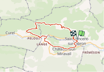
Trail Walking of 16.1 km to be discovered at Provence-Alpes-Côte d'Azur, Alpes-de-Haute-Provence, Saint-Vincent-sur-Jabron. This trail is proposed by Clo0413.
Positioning
Country:
France
Region :
Provence-Alpes-Côte d'Azur
Department/Province :
Alpes-de-Haute-Provence
Municipality :
Saint-Vincent-sur-Jabron
Location:
Unknown
Start:(Dec)
Start:(UTM)
719264 ; 4894601 (31T) N.
Comments