


Hautes fagnes

cobut.jp@gmail.com
User
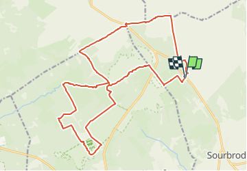

Length
21 km

Max alt
700 m

Uphill gradient
328 m
Km-Effort
25 km

Min alt
568 m

Downhill gradient
329 m
Boucle
Yes
Creation date :
2023-01-27 16:36:10.61
Updated on :
2023-01-27 16:43:03.59
5h45
Difficulty : Medium

FREE GPS app for hiking
 SityTrail
IGN / Geographical institutes
SityTrail Plus
The world is yours!
About
Trail On foot of 21 km to be discovered at Wallonia, Liège, Waimes. This trail is proposed by cobut.jp@gmail.com.
Description
signal de Botrange -réserve naturelle des hautes fagnes -Baraque Michel - croix des fiancés-fagnes de Setay-fagne de Polleur -signal de botrange
Positioning
Country:
Belgium
Region :
Wallonia
Department/Province :
Liège
Municipality :
Waimes
Location:
Robertville
Start:(Dec)
Start:(UTM)
293850 ; 5598454 (32U) N.
Comments