


Chemin d'Arles 12 Arles

berlage
User
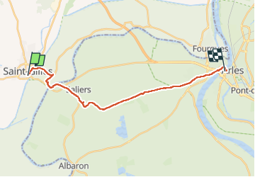

Length
21 km

Max alt
17 m

Uphill gradient
89 m
Km-Effort
22 km

Min alt
-2 m

Downhill gradient
79 m
Boucle
No
Creation date :
2023-01-28 09:04:48.811
Updated on :
2023-01-28 13:42:58.375
4h37
Difficulty : Medium

FREE GPS app for hiking
 SityTrail
IGN / Geographical institutes
SityTrail Plus
The world is yours!
About
Trail Walking of 21 km to be discovered at Occitania, Gard, Saint-Gilles. This trail is proposed by berlage.
Positioning
Country:
France
Region :
Occitania
Department/Province :
Gard
Municipality :
Saint-Gilles
Location:
Unknown
Start:(Dec)
Start:(UTM)
615460 ; 4836646 (31T) N.
Comments