


villecroze st barthelemy tholos lauve

clintest
User
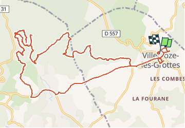

Length
17.7 km

Max alt
454 m

Uphill gradient
482 m
Km-Effort
24 km

Min alt
278 m

Downhill gradient
482 m
Boucle
Yes
Creation date :
2023-01-28 16:38:29.273
Updated on :
2023-01-28 16:40:25.103
5h28
Difficulty : Very difficult

FREE GPS app for hiking
 SityTrail
IGN / Geographical institutes
SityTrail Plus
The world is yours!
About
Trail Walking of 17.7 km to be discovered at Provence-Alpes-Côte d'Azur, Var, Villecroze. This trail is proposed by clintest.
Positioning
Country:
France
Region :
Provence-Alpes-Côte d'Azur
Department/Province :
Var
Municipality :
Villecroze
Location:
Unknown
Start:(Dec)
Start:(UTM)
280029 ; 4829201 (32T) N.
Comments
belle randonnée