


Sensei st mat

rio34740
User

Length
40 km

Max alt
157 m

Uphill gradient
388 m
Km-Effort
45 km

Min alt
20 m

Downhill gradient
452 m
Boucle
No
Creation date :
2023-01-15 10:06:33.0
Updated on :
2023-01-29 14:07:12.364
5h15
Difficulty : Easy

FREE GPS app for hiking
 SityTrail
IGN / Geographical institutes
SityTrail Plus
The world is yours!
About
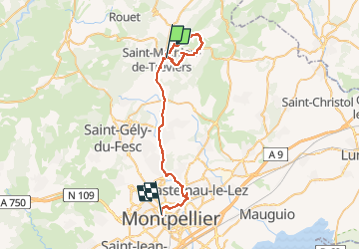
Trail Walking of 40 km to be discovered at Occitania, Hérault, Saint-Mathieu-de-Tréviers. This trail is proposed by rio34740.
Description
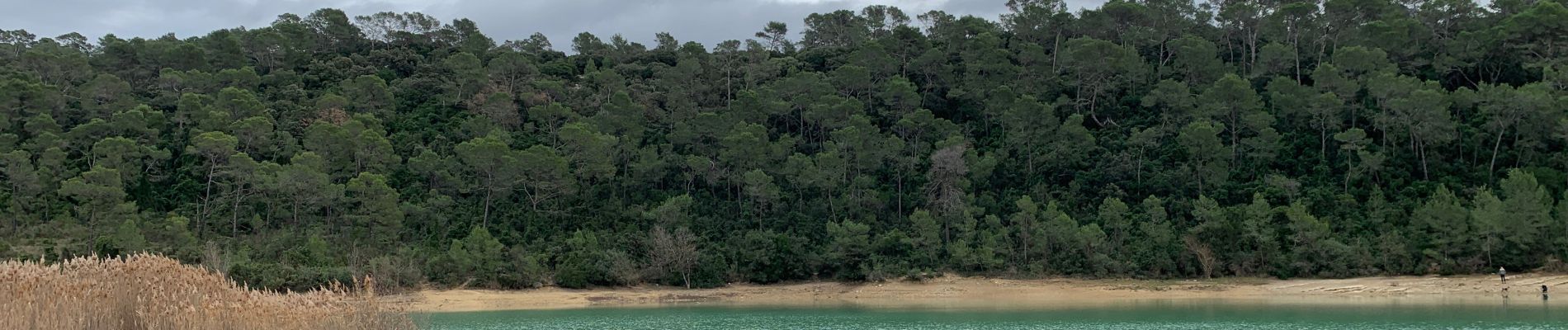
Belle randonnée avec vue sur L’Hortus et le Pic saint loup…
Photos


Positioning
Country:
France
Region :
Occitania
Department/Province :
Hérault
Municipality :
Saint-Mathieu-de-Tréviers
Location:
Unknown
Start:(Dec)
Start:(UTM)
570154 ; 4846867 (31T) N.
Comments