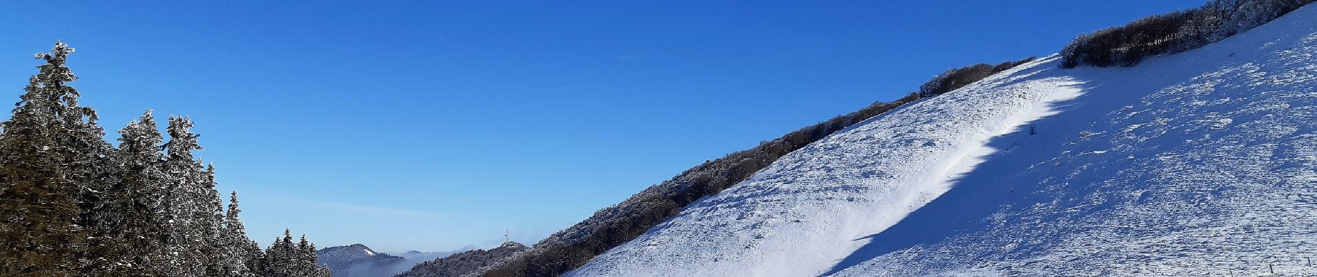
Trail Walking Bouvante - Crête des Gagères - Photo
 Greg813
Greg813

User

© OpenStreetMap contributors
Length
Length
8.3 km
Max alt
Max alt
1536 m
Uphill gradient
Uphill gradient
252 m
Km-Effort
Km-Effort  
11.6 km
Min alt
Min alt
1339 m
Downhill gradient
Downhill gradient
251 m
Boucle
Boucle
Yes
Creation date :
2023-01-29 08:51:25.808
Updated on :
2023-02-25 09:53:15.92

(0 Reviews)

Walking
Walking
2h10
Difficulty : Medium

Scan this QR Code to open this trail in the SityTrail application

FREE GPS app for hiking

Logo SityTrail SityTrail

IGN / Geographical institutes

Download SityTrail from the App Store Download SityTrail from Google Play

Logo SityTrail SityTrail Plus

The world is yours!

Download SityTrail from the App Store Download SityTrail from Google Play Download SityTrail on Huawei AppGallery

About

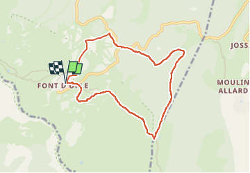
Trail Walking of 8.3 km to be discovered at Auvergne-Rhône-Alpes, Drôme, Bouvante. This trail is proposed by Greg813.

Description

Randonnée avec Mettons le Monde en Marche, de la station de Font d'Urle à la Crête des Gagères.

Cheminement en raquettes en période hivernale.

Pour d'autres photos, voir le site de l'association :
https://mmm-rando.org/decouverte-hivernale-du-vercors-randos-raquettes/

Elevation profile

Photos

Positioning

Country:
France
Region :
Auvergne-Rhône-Alpes
Department/Province :
Drôme
Municipality :
Bouvante
Location:
Unknown
Start:(UTM)
683360 ; 4974396 (31T) N.


Close
My subscriptions