


Beausoleil la boucle

sameja
User
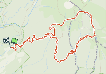

Length
13.5 km

Max alt
1386 m

Uphill gradient
852 m
Km-Effort
25 km

Min alt
746 m

Downhill gradient
852 m
Boucle
Yes
Creation date :
2023-01-26 11:50:29.0
Updated on :
2023-01-30 10:28:40.887
2h11
Difficulty : Difficult

FREE GPS app for hiking
 SityTrail
IGN / Geographical institutes
SityTrail Plus
The world is yours!
About
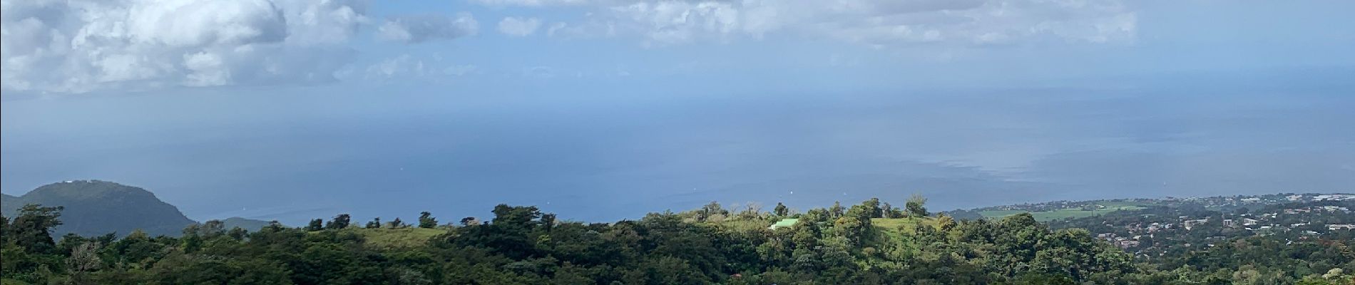
Trail Trail of 13.5 km to be discovered at Guadeloupe, Unknown, Saint-Claude. This trail is proposed by sameja.
Description
Armistice échelle
Photos


Positioning
Country:
France
Region :
Guadeloupe
Department/Province :
Unknown
Municipality :
Saint-Claude
Location:
Unknown
Start:(Dec)
Start:(UTM)
641134 ; 1772835 (20Q) N.
Comments