


Colombiers

Roger Philippe Wallez
User GUIDE
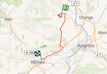

Length
68 km

Max alt
280 m

Uphill gradient
825 m
Km-Effort
80 km

Min alt
20 m

Downhill gradient
875 m
Boucle
No
Creation date :
2023-01-30 09:21:15.0
Updated on :
2023-01-30 16:38:00.281
7h15
Difficulty : Very difficult

FREE GPS app for hiking
 SityTrail
IGN / Geographical institutes
SityTrail Plus
The world is yours!
About
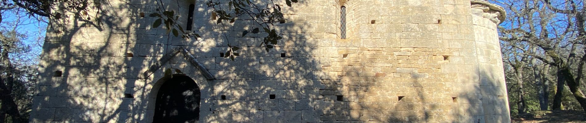
Trail Walking of 68 km to be discovered at Occitania, Gard, Sabran. This trail is proposed by Roger Philippe Wallez.
Photos


Positioning
Country:
France
Region :
Occitania
Department/Province :
Gard
Municipality :
Sabran
Location:
Unknown
Start:(Dec)
Start:(UTM)
626586 ; 4890415 (31T) N.
Comments