


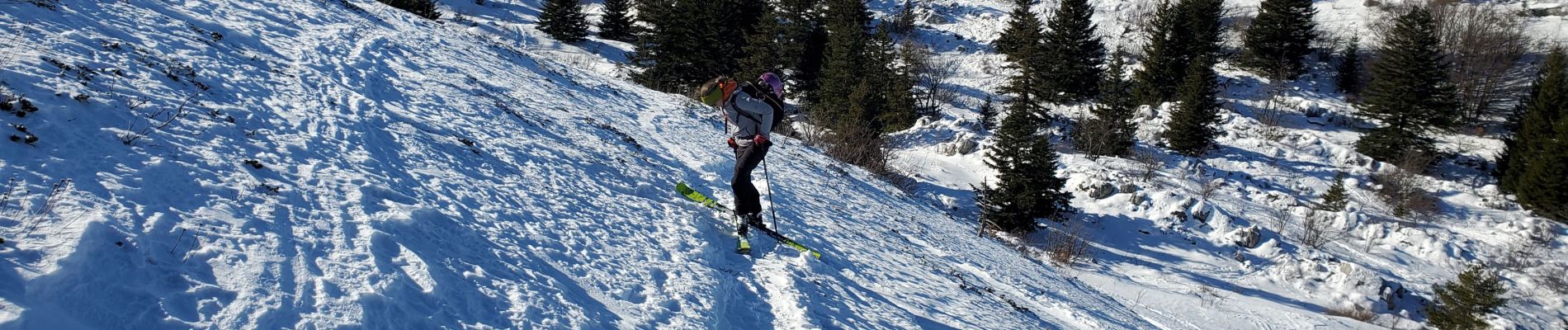
Lans en Vercors par combe oursiere

ericf64
User
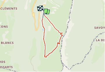

Length
5.2 km

Max alt
1861 m

Uphill gradient
406 m
Km-Effort
10.7 km

Min alt
1413 m

Downhill gradient
429 m
Boucle
Yes
Creation date :
2023-01-31 09:34:34.048
Updated on :
2023-01-31 12:52:38.707
3h03
Difficulty : Easy

FREE GPS app for hiking
 SityTrail
IGN / Geographical institutes
SityTrail Plus
The world is yours!
About
Trail Touring skiing of 5.2 km to be discovered at Auvergne-Rhône-Alpes, Isère, Lans-en-Vercors. This trail is proposed by ericf64.
Photos

Positioning
Country:
France
Region :
Auvergne-Rhône-Alpes
Department/Province :
Isère
Municipality :
Lans-en-Vercors
Location:
Unknown
Start:(Dec)
Start:(UTM)
705158 ; 4998550 (31T) N.
Comments