Trail Walking Cartagena - camera de la fuente - Photo
© OpenStreetMap contributors
Length
Length
8.2 km
Max alt
Max alt
136 m
Uphill gradient
Uphill gradient
167 m
Km-Effort
Km-Effort  
10.4 km
Min alt
Min alt
9 m
Downhill gradient
Downhill gradient
168 m
Boucle
Boucle
Yes
Creation date :
2023-01-31 10:50:54.548
Updated on :
2023-01-31 14:56:16.568

(0 Reviews)

Walking
Walking
2h35
Difficulty : Difficult

Scan this QR Code to open this trail in the SityTrail application

FREE GPS app for hiking

Logo SityTrail SityTrail

IGN / Geographical institutes

Download SityTrail from the App Store Download SityTrail from Google Play

Logo SityTrail SityTrail World

The world is yours!

Download SityTrail from the App Store Download SityTrail from Google Play Download SityTrail on Huawei AppGallery

About

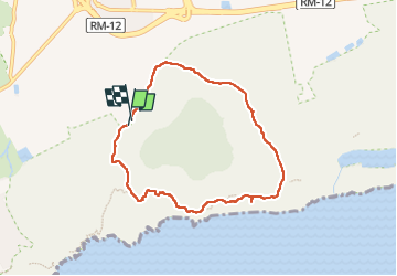
Trail Walking of 8.2 km to be discovered at Region of Murcia, Region of Murcia, Cartagena. This trail is proposed by bometdehamer.

Description

Une promenade circulaire de  /_ 8 km, avec une descente spectaculaire vers la mer. De là, on monte doucement.

Elevation profile

Positioning

Country:
Spain
Region :
Region of Murcia
Department/Province :
Region of Murcia
Municipality :
Cartagena
Location:
Diputación de Rincón de San Ginés
Start:(UTM)
696239 ; 4164700 (30S) N.

Trails nearby

Trail On foot Cartagena - PR-MU 1 Vuelta al cabezo de la fuente - Photo
On foot
PRO

On foot

Easy
Cartagena, Region of Murcia, Region of Murcia, Spain
7.8 km | 10.1 km-effort
2h 17min
Yes


Close
My subscriptions