Trail Walking Saint-Agnan-en-Vercors - Les Hauts Plateaux du Vercors - Photo
 Greg813
Greg813

User

© OpenStreetMap contributors
Length
Length
12 km
Max alt
Max alt
1483 m
Uphill gradient
Uphill gradient
530 m
Km-Effort
Km-Effort  
19.1 km
Min alt
Min alt
976 m
Downhill gradient
Downhill gradient
531 m
Boucle
Boucle
Yes
Creation date :
2023-02-02 08:49:15.714
Updated on :
2023-02-25 09:53:02.998

(0 Reviews)

Walking
Walking
3h51
Difficulty : Difficult

Scan this QR Code to open this trail in the SityTrail application

FREE GPS app for hiking

Logo SityTrail SityTrail

IGN / Geographical institutes

Download SityTrail from the App Store Download SityTrail from Google Play

Logo SityTrail SityTrail Plus

The world is yours!

Download SityTrail from the App Store Download SityTrail from Google Play Download SityTrail on Huawei AppGallery

About

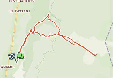
Trail Walking of 12 km to be discovered at Auvergne-Rhône-Alpes, Drôme, Saint-Agnan-en-Vercors. This trail is proposed by Greg813.

Description

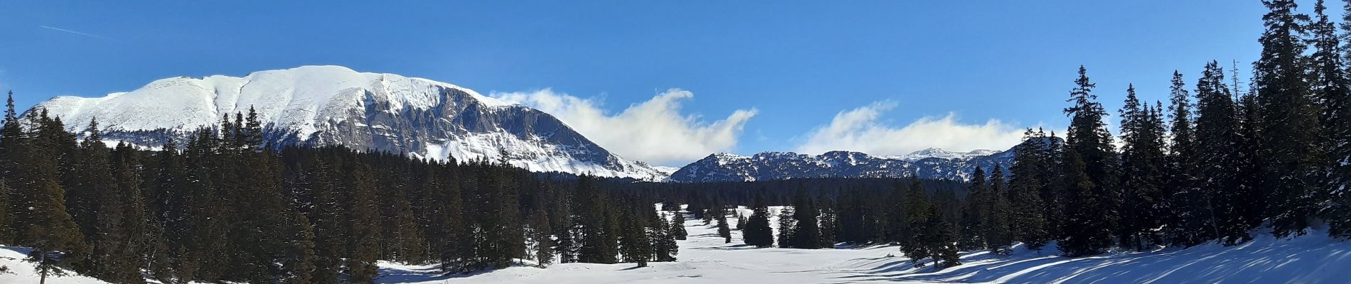
Randonnée avec Mettons le Monde en Marche, au cœur du Vercors.

Ascension de Rousset en Vercors jusqu'aux Hauts Plateaux par la piste de Chauvet et la route de Rachier.

Réalisé en raquettes en période hivernale.

Pour d'autres photos, voir le site de l'association :
https://mmm-rando.org/decouverte-hivernale-du-vercors-randos-raquettes/

Elevation profile

Photos

Positioning

Country:
France
Region :
Auvergne-Rhône-Alpes
Department/Province :
Drôme
Municipality :
Saint-Agnan-en-Vercors
Location:
Unknown
Start:(UTM)
691265 ; 4971432 (31T) N.


Close
My subscriptions