


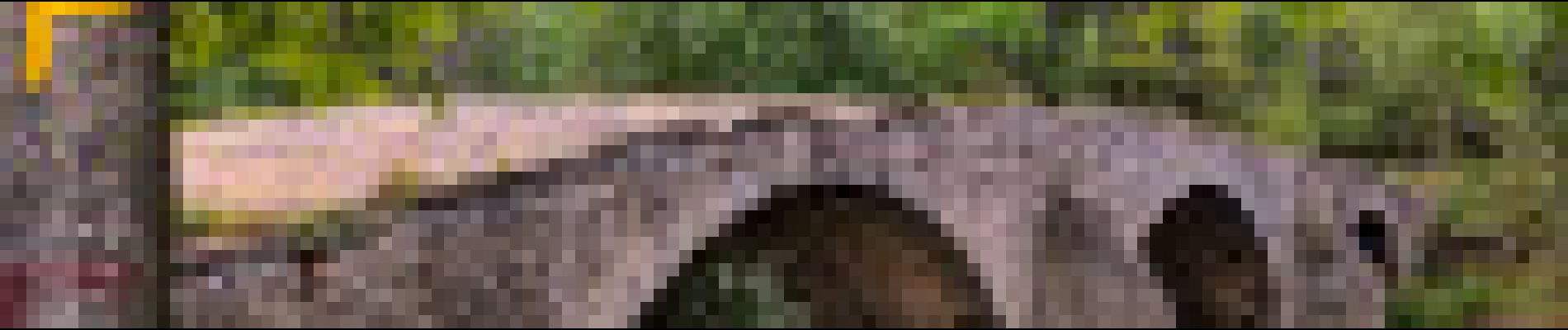
La Chapelle d'Aleyrac et le Pont des Cammaous

ARVIEU
User

Length
12.2 km

Max alt
171 m

Uphill gradient
172 m
Km-Effort
14.5 km

Min alt
94 m

Downhill gradient
175 m
Boucle
Yes
Creation date :
2023-02-03 08:12:32.885
Updated on :
2023-02-03 08:14:57.684
4h00
Difficulty : Easy

FREE GPS app for hiking
 SityTrail
IGN / Geographical institutes
SityTrail Plus
The world is yours!
About
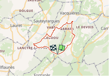
Trail Walking of 12.2 km to be discovered at Occitania, Hérault, Vacquières. This trail is proposed by ARVIEU.
Photos


Positioning
Country:
France
Region :
Occitania
Department/Province :
Hérault
Municipality :
Vacquières
Location:
Unknown
Start:(Dec)
Start:(UTM)
574927 ; 4851281 (31T) N.
Comments