


Chenal

Henri.Vekemans
User
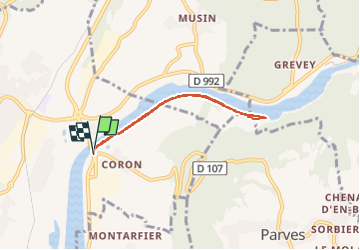

Length
5.3 km

Max alt
243 m

Uphill gradient
25 m
Km-Effort
5.6 km

Min alt
229 m

Downhill gradient
25 m
Boucle
Yes
Creation date :
2023-02-04 14:36:48.315
Updated on :
2023-02-04 15:50:09.437
1h12
Difficulty : Easy

FREE GPS app for hiking
 SityTrail
IGN / Geographical institutes
SityTrail Plus
The world is yours!
About
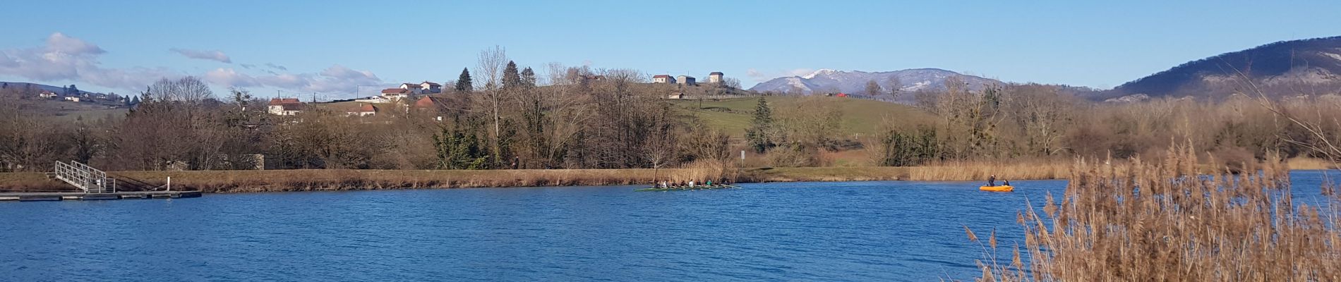
Trail Walking of 5.3 km to be discovered at Auvergne-Rhône-Alpes, Ain, Belley. This trail is proposed by Henri.Vekemans.
Photos


Positioning
Country:
France
Region :
Auvergne-Rhône-Alpes
Department/Province :
Ain
Municipality :
Belley
Location:
Unknown
Start:(Dec)
Start:(UTM)
710654 ; 5070308 (31T) N.
Comments