


sommet Quarlie

oliviergau
User
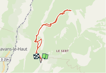

Length
9.2 km

Max alt
2315 m

Uphill gradient
752 m
Km-Effort
19.3 km

Min alt
1559 m

Downhill gradient
753 m
Boucle
Yes
Creation date :
2023-01-24 08:57:35.371
Updated on :
2023-02-05 12:47:09.19
4h40
Difficulty : Very easy

FREE GPS app for hiking
 SityTrail
IGN / Geographical institutes
SityTrail Plus
The world is yours!
About
Trail Touring skiing of 9.2 km to be discovered at Auvergne-Rhône-Alpes, Isère, Besse. This trail is proposed by oliviergau.
Positioning
Country:
France
Region :
Auvergne-Rhône-Alpes
Department/Province :
Isère
Municipality :
Besse
Location:
Unknown
Start:(Dec)
Start:(UTM)
278016 ; 4995425 (32T) N.
Comments