


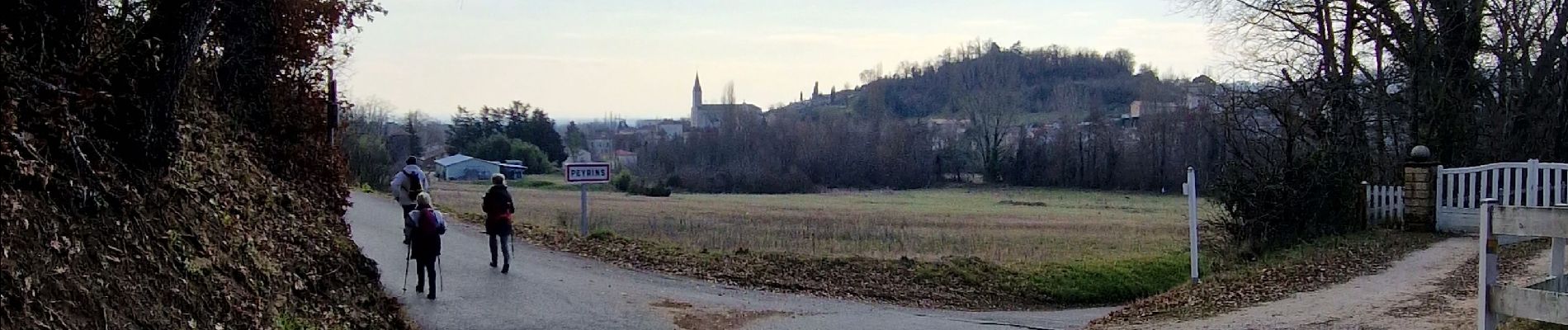
Peyrins Saint Ange

meillon
User
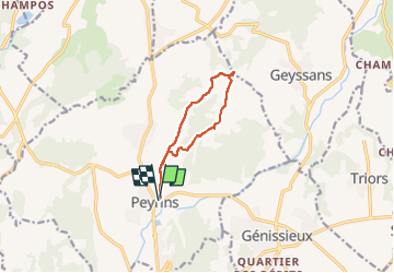

Length
9 km

Max alt
435 m

Uphill gradient
261 m
Km-Effort
12.5 km

Min alt
205 m

Downhill gradient
261 m
Boucle
Yes
Creation date :
2023-02-09 09:34:25.262
Updated on :
2023-02-09 13:42:36.348
4h07
Difficulty : Easy

FREE GPS app for hiking
 SityTrail
IGN / Geographical institutes
SityTrail Plus
The world is yours!
About
Trail Walking of 9 km to be discovered at Auvergne-Rhône-Alpes, Drôme, Peyrins. This trail is proposed by meillon.
Description
parcours sympa, montée jusqu'à la chapelle
Photos

Positioning
Country:
France
Region :
Auvergne-Rhône-Alpes
Department/Province :
Drôme
Municipality :
Peyrins
Location:
Unknown
Start:(Dec)
Start:(UTM)
661226 ; 4995289 (31T) N.
Comments