


pn gondreville

PascalBoutroue
User
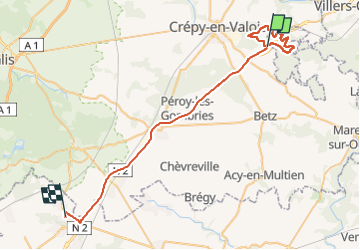

Length
45 km

Max alt
159 m

Uphill gradient
392 m
Km-Effort
51 km

Min alt
90 m

Downhill gradient
418 m
Boucle
No
Creation date :
2023-02-09 08:39:13.816
Updated on :
2023-02-09 14:24:40.41
5h01
Difficulty : Difficult

FREE GPS app for hiking
 SityTrail
IGN / Geographical institutes
SityTrail Plus
The world is yours!
About
Trail Walking of 45 km to be discovered at Hauts-de-France, Oise, Gondreville. This trail is proposed by PascalBoutroue.
Description
randonnée figée sur carte
Positioning
Country:
France
Region :
Hauts-de-France
Department/Province :
Oise
Municipality :
Gondreville
Location:
Unknown
Start:(Dec)
Start:(UTM)
496881 ; 5451641 (31U) N.
Comments