Trail Nordic walking Givet - Circuit du Mont d'Haurs - Photo

Circuit du Mont d'Haurs

© OpenStreetMap contributors
Length
Length
4.4 km
Max alt
Max alt
209 m
Uphill gradient
Uphill gradient
115 m
Km-Effort
Km-Effort  
5.9 km
Min alt
Min alt
92 m
Downhill gradient
Downhill gradient
116 m
Boucle
Boucle
Yes
Creation date :
2023-02-09 17:34:37.397
Updated on :
2023-02-09 17:59:39.716

(0 Reviews)

Nordic walking
Nordic walking
1h19
Difficulty : Easy

Scan this QR Code to open this trail in the SityTrail application

FREE GPS app for hiking

Logo SityTrail SityTrail

IGN / Geographical institutes

Download SityTrail from the App Store Download SityTrail from Google Play

Logo SityTrail SityTrail World

The world is yours!

Download SityTrail from the App Store Download SityTrail from Google Play Download SityTrail on Huawei AppGallery

About

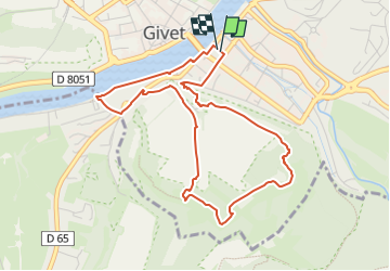
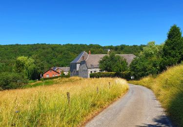
Trail Nordic walking of 4.4 km to be discovered at Grand Est, Ardennes, Givet. This trail is proposed by denissculier.

Description

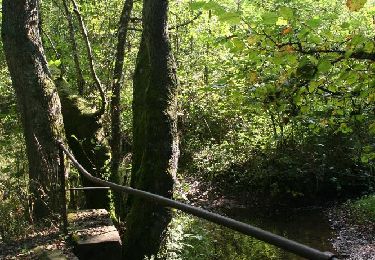
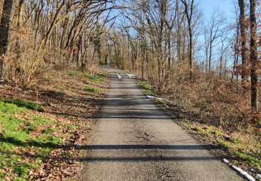
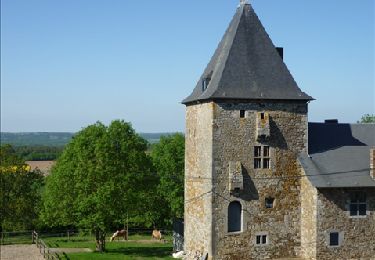
Depuis les hauteurs du Mont d’Haurs, découvrez, à deux pas de la ville, un site remarquable par sa quiétude mais aussi par les vestiges de son architecture militaire du début du 18e siècle. On les aperçoit au détour du sentier, derrière un boisement de pins ou sous une fragile pelouse sèche qui a valu au site d’être classé Réserve Naturelle Nationale.

Elevation profile

Positioning

Country:
France
Region :
Grand Est
Department/Province :
Ardennes
Municipality :
Givet
Location:
Unknown
Start:(UTM)
630731 ; 5555277 (31U) N.

Trails nearby

Trail Walking Beauraing - Winenne - Nature: trip to the countryside - Photo
Walking
PRO

Walking

Difficult
(7)
Beauraing, Wallonia, Namur, Belgium
20 km | 26 km-effort
6h 0min
Yes
Trail Walking Givet - Balade à Givet - Photo
Walking
tracegps

Walking

Medium
(3)
Givet, Grand Est, Ardennes, France
8 km | 9.4 km-effort
2h 0min
Yes
Trail Walking Givet - Promenade sur les remparts du Mont d'Haurs - Photo
Walking
tracegps

Walking

Medium
(3)
Givet, Grand Est, Ardennes, France
5.1 km | 6.7 km-effort
2h 0min
Yes
Trail Walking Hastière - Hastiere, Entre mont et vallée - Photo
Walking
pito0206

Walking

Medium
(2)
Hastière, Wallonia, Namur, Belgium
11.2 km | 14.3 km-effort
2h 5min
Yes
Trail Mountain bike Beauraing - Winenne - Nature: trip to the countryside - Photo
Mountain bike
PRO

Mountain bike

Medium
(3)
Beauraing, Wallonia, Namur, Belgium
20 km | 26 km-effort
1h 41min
Yes
Trail Walking Rancennes - De Rancennes à Charnois par les Rochers du Petit Chooz - Photo
Walking
GUIDE
Desrumaux

Walking

Easy
(1)
Rancennes, Grand Est, Ardennes, France
10.6 km | 14.6 km-effort
2h 30min
Yes
Trail Walking Beauraing - Balade de Dion à Winenne - Beauraing - Photo
Walking
GUIDE
Desrumaux

Walking

Medium
(1)
Beauraing, Wallonia, Namur, Belgium
6.5 km | 8.5 km-effort
1h 55min
Yes
Trail Walking Beauraing - Balade à Winenne - Beauraing - Photo
Walking
GUIDE
Desrumaux

Walking

Difficult
Beauraing, Wallonia, Namur, Belgium
11.7 km | 14.7 km-effort
3h 20min
Yes
Trail Walking Houyet - Marche Adeps à Mesnil-Saint-Blaise - Photo
Walking
GUIDE
Desrumaux

Walking

Medium
Houyet, Wallonia, Namur, Belgium
9.8 km | 11.4 km-effort
2h 35min
Yes


Close
My subscriptions