


230211a

Gilou70
User

Length
6 km

Max alt
274 m

Uphill gradient
46 m
Km-Effort
6.6 km

Min alt
252 m

Downhill gradient
45 m
Boucle
Yes
Creation date :
2023-02-10 13:33:12.435
Updated on :
2023-02-10 14:39:33.28
1h06
Difficulty : Easy

FREE GPS app for hiking
 SityTrail
IGN / Geographical institutes
SityTrail Plus
The world is yours!
About
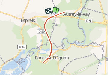
Trail Walking of 6 km to be discovered at Bourgogne-Franche-Comté, Haute-Saône, Esprels. This trail is proposed by Gilou70.
Positioning
Country:
France
Region :
Bourgogne-Franche-Comté
Department/Province :
Haute-Saône
Municipality :
Esprels
Location:
Unknown
Start:(Dec)
Start:(UTM)
303372 ; 5268110 (32T) N.
Comments