


contres

lecmic
User
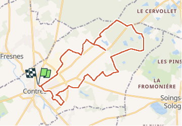

Length
20 km

Max alt
127 m

Uphill gradient
119 m
Km-Effort
22 km

Min alt
98 m

Downhill gradient
119 m
Boucle
Yes
Creation date :
2023-02-12 06:17:19.196
Updated on :
2023-02-12 09:44:56.285
3h27
Difficulty : Easy

FREE GPS app for hiking
 SityTrail
IGN / Geographical institutes
SityTrail Plus
The world is yours!
About
Trail Walking of 20 km to be discovered at Centre-Loire Valley, Loir-et-Cher, Le Controis-en-Sologne. This trail is proposed by lecmic.
Description
sapeurs pompiers
l
Positioning
Country:
France
Region :
Centre-Loire Valley
Department/Province :
Loir-et-Cher
Municipality :
Le Controis-en-Sologne
Location:
Unknown
Start:(Dec)
Start:(UTM)
381663 ; 5253144 (31T) N.
Comments