


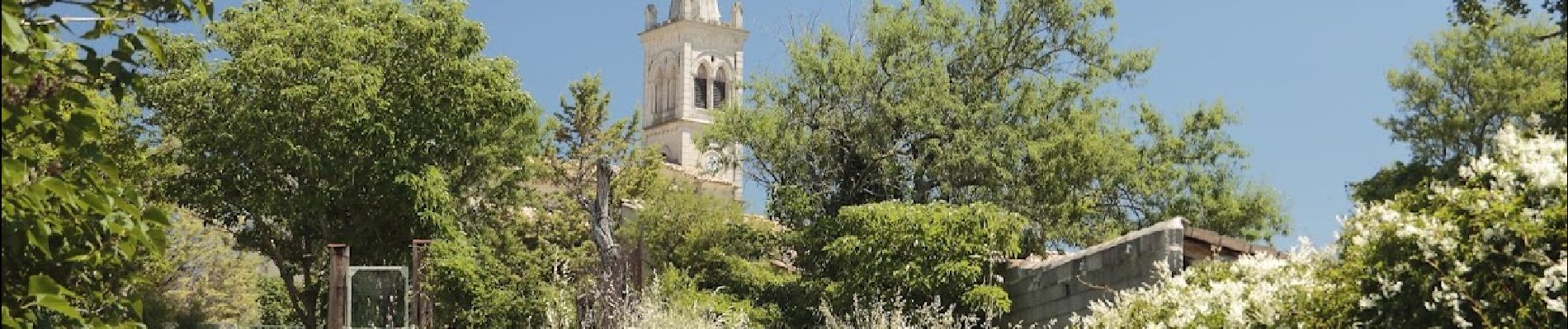
Montjoyer-Chapelle St Pierre 9km.

chancha
User GUIDE
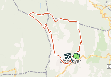

Length
8.6 km

Max alt
413 m

Uphill gradient
144 m
Km-Effort
10.5 km

Min alt
318 m

Downhill gradient
143 m
Boucle
Yes
Creation date :
2023-02-12 13:07:05.282
Updated on :
2025-02-16 09:23:49.479
3h03
Difficulty : Easy

FREE GPS app for hiking
 SityTrail
IGN / Geographical institutes
SityTrail Plus
The world is yours!
About
Trail Walking of 8.6 km to be discovered at Auvergne-Rhône-Alpes, Drôme, Montjoyer. This trail is proposed by chancha.
Photos


Positioning
Country:
France
Region :
Auvergne-Rhône-Alpes
Department/Province :
Drôme
Municipality :
Montjoyer
Location:
Unknown
Start:(Dec)
Start:(UTM)
647479 ; 4926497 (31T) N.
Comments