Trail Horseback riding Malpas - EQU-INTEGRALE-2021 - Photo
 aeldin
aeldin

User

© OpenStreetMap contributors
Length
Length
36 km
Max alt
Max alt
1045 m
Uphill gradient
Uphill gradient
502 m
Km-Effort
Km-Effort  
44 km
Min alt
Min alt
622 m
Downhill gradient
Downhill gradient
812 m
Boucle
Boucle
No
Creation date :
2023-02-12 17:47:32.71
Updated on :
2023-06-15 22:53:04.207

(0 Reviews)

Horseback riding
Horseback riding
5h45
Difficulty : Very difficult

Scan this QR Code to open this trail in the SityTrail application

FREE GPS app for hiking

Logo SityTrail SityTrail

IGN / Geographical institutes

Download SityTrail from the App Store Download SityTrail from Google Play

Logo SityTrail SityTrail World

The world is yours!

Download SityTrail from the App Store Download SityTrail from Google Play Download SityTrail on Huawei AppGallery

About

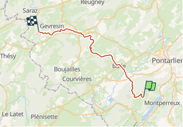
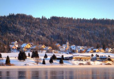
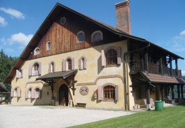
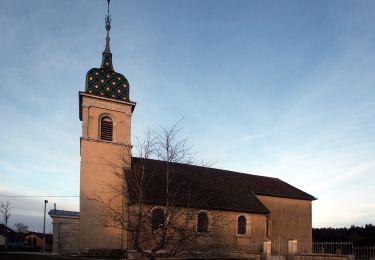
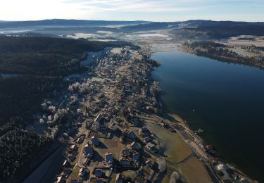
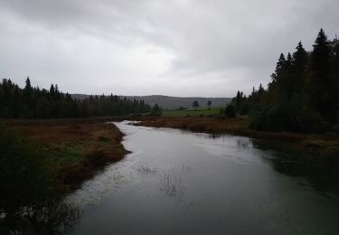
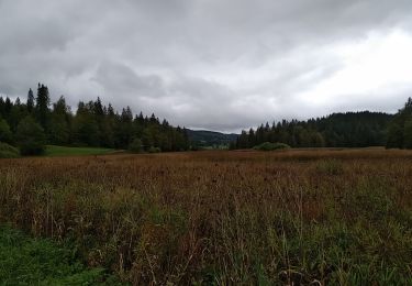
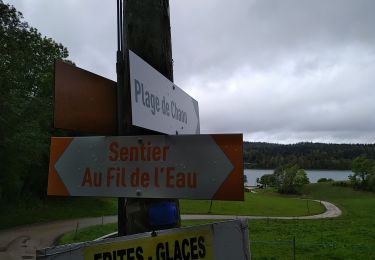
Trail Horseback riding of 36 km to be discovered at Bourgogne-Franche-Comté, Doubs, Malpas. This trail is proposed by aeldin.

Elevation profile

Points of interest

Point of interest Crouzet-Migette - Ferme équestre du Pont du Diable - Photo
aeldin
Point of interest Crouzet-Migette - L'Auberge du Pont du Diable - Photo
aeldin
Point of interest Malpas - Le Relais de Malpas - Photo
aeldin
Point of interest Gevresin - On peut couper ?  - Photo
aeldin

Positioning

Country:
France
Region :
Bourgogne-Franche-Comté
Department/Province :
Doubs
Municipality :
Malpas
Location:
Unknown
Start:(UTM)
293345 ; 5190467 (32T) N.

Trails nearby

Trail On foot Saint-Point-Lac - La Ronde des Deux Villages - Photo
On foot
PRO

On foot

Easy
Saint-Point-Lac, Bourgogne-Franche-Comté, Doubs, France
5.5 km | 7.3 km-effort
1h 40min
Yes
Trail On foot Les Grangettes - La Pierre qui Tourne - Photo
On foot
PRO

On foot

Easy
Les Grangettes, Bourgogne-Franche-Comté, Doubs, France
8.2 km | 10.7 km-effort
2h 25min
Yes
Trail On foot Malpas - Le Tour du Lac de Malpas - Photo
On foot
PRO

On foot

Easy
Malpas, Bourgogne-Franche-Comté, Doubs, France
4.9 km | 5.7 km-effort
1h 17min
Yes
Trail On foot Malbuisson - Sentier du Tour du Lac - Photo
On foot
PRO

On foot

Easy
Malbuisson, Bourgogne-Franche-Comté, Doubs, France
16 km | 19.9 km-effort
4h 30min
No
Trail Nordic walking Malbuisson - Fort St Antoine  - Photo
Nordic walking
mallovon

Nordic walking

Easy
Malbuisson, Bourgogne-Franche-Comté, Doubs, France
5.8 km | 7.3 km-effort
2h 21min
Yes
Trail Walking Montperreux - Chaon Saint Point - Lac - Photo
Walking
helmut68

Walking

Easy
(1)
Montperreux, Bourgogne-Franche-Comté, Doubs, France
15.1 km | 19.4 km-effort
3h 5min
Yes
Trail Walking Montperreux - Sentier de la découverte - Chaon Malbuisson - Photo
Walking
helmut68

Walking

Easy
Montperreux, Bourgogne-Franche-Comté, Doubs, France
9.8 km | 12.3 km-effort
2h 12min
Yes
Trail Walking Montperreux -                                     La Gouille - Photo
Walking
helmut68

Walking

Easy
Montperreux, Bourgogne-Franche-Comté, Doubs, France
8 km | 10.1 km-effort
1h 53min
Yes
Trail Walking Montperreux - La source bleue - Photo
Walking
helmut68

Walking

Easy
Montperreux, Bourgogne-Franche-Comté, Doubs, France
9.8 km | 13.4 km-effort
2h 13min
Yes


Close
My subscriptions