


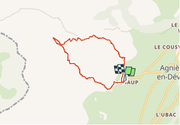
Rocher Rond ou presque

oliviergau
User

Length
7.3 km

Max alt
1997 m

Uphill gradient
596 m
Km-Effort
15.3 km

Min alt
1395 m

Downhill gradient
606 m
Boucle
Yes
Creation date :
2023-02-13 08:30:18.446
Updated on :
2023-02-13 13:14:54.22
4h44
Difficulty : Very easy

FREE GPS app for hiking
 SityTrail
IGN / Geographical institutes
SityTrail Plus
The world is yours!
About
Trail Touring skiing of 7.3 km to be discovered at Provence-Alpes-Côte d'Azur, Hautes-Alpes, Le Dévoluy. This trail is proposed by oliviergau.
Positioning
Country:
France
Region :
Provence-Alpes-Côte d'Azur
Department/Province :
Hautes-Alpes
Municipality :
Le Dévoluy
Location:
Agnières-en-Dévoluy
Start:(Dec)
Start:(UTM)
726849 ; 4952657 (31T) N.
Comments