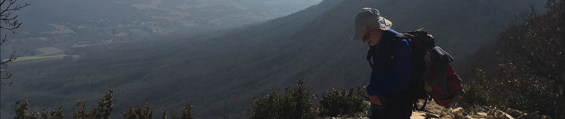
Trail Walking Le Poët-Laval - Mont Rachas  - Photo
 ajd26
ajd26

User

© OpenStreetMap contributors
Length
Length
14.8 km
Max alt
Max alt
894 m
Uphill gradient
Uphill gradient
694 m
Km-Effort
Km-Effort  
24 km
Min alt
Min alt
296 m
Downhill gradient
Downhill gradient
695 m
Boucle
Boucle
Yes
Creation date :
2023-02-16 08:45:43.0
Updated on :
2023-02-22 16:21:24.566

(0 Reviews)

Walking
Walking
4h20
Difficulty : Medium

Scan this QR Code to open this trail in the SityTrail application

FREE GPS app for hiking

Logo SityTrail SityTrail

IGN / Geographical institutes

Download SityTrail from the App Store Download SityTrail from Google Play

Logo SityTrail SityTrail Plus

The world is yours!

Download SityTrail from the App Store Download SityTrail from Google Play Download SityTrail on Huawei AppGallery

About

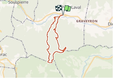
Trail Walking of 14.8 km to be discovered at Auvergne-Rhône-Alpes, Drôme, Le Poët-Laval. This trail is proposed by ajd26.

Description

départ de Gougnes (Poet-Laval)
montée très sympa jusqu'au Mont Rachas
on a un peut batailler pour le début du retour (km 9,6) car il y a eu une coupe de bois et des ronces ont repoussé
après km 9,9, on retrouve le chemin du retour très agréable qui passe à Richon

Elevation profile

Photos

Positioning

Country:
France
Region :
Auvergne-Rhône-Alpes
Department/Province :
Drôme
Municipality :
Le Poët-Laval
Location:
Unknown
Start:(UTM)
659619 ; 4932756 (31T) N.


Close
My subscriptions