


regate hyeres 12-02-23

bernir
User
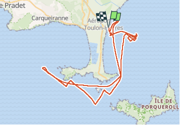

Length
47 km

Max alt
3 m

Uphill gradient
3 m
Km-Effort
47 km

Min alt
0 m

Downhill gradient
3 m
Boucle
Yes
Creation date :
2023-02-12 08:57:36.652
Updated on :
2023-02-18 10:01:52.092
8h20
Difficulty : Easy

FREE GPS app for hiking
 SityTrail
IGN / Geographical institutes
SityTrail Plus
The world is yours!
About
Trail Walking of 47 km to be discovered at Provence-Alpes-Côte d'Azur, Var, Hyères. This trail is proposed by bernir.
Description
ou l'on peut observer que le bord au large n'a pas été payan!
Positioning
Country:
France
Region :
Provence-Alpes-Côte d'Azur
Department/Province :
Var
Municipality :
Hyères
Location:
Unknown
Start:(Dec)
Start:(UTM)
268623 ; 4773753 (32T) N.
Comments