


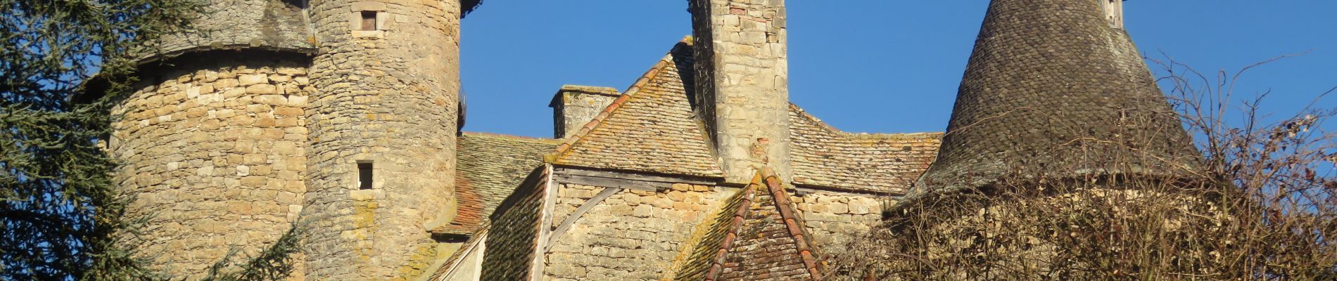
Thégra - Circuit des fontaines

houbart
User

Length
11.5 km

Max alt
426 m

Uphill gradient
213 m
Km-Effort
14.4 km

Min alt
323 m

Downhill gradient
215 m
Boucle
Yes
Creation date :
2023-02-17 10:14:31.912
Updated on :
2023-02-21 09:25:44.282
3h10
Difficulty : Difficult

FREE GPS app for hiking
 SityTrail
IGN / Geographical institutes
SityTrail Plus
The world is yours!
About
Trail Walking of 11.5 km to be discovered at Occitania, Lot, Thégra. This trail is proposed by houbart.
Photos


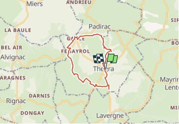
Positioning
Country:
France
Region :
Occitania
Department/Province :
Lot
Municipality :
Thégra
Location:
Unknown
Start:(Dec)
Start:(UTM)
401718 ; 4963771 (31T) N.
Comments