


col de la ligne. st Hubert

fernandezyvan
User
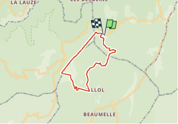

Length
12.1 km

Max alt
873 m

Uphill gradient
258 m
Km-Effort
15.5 km

Min alt
682 m

Downhill gradient
257 m
Boucle
Yes
Creation date :
2023-02-17 08:43:01.184
Updated on :
2023-02-17 14:18:18.53
4h23
Difficulty : Difficult

FREE GPS app for hiking
 SityTrail
IGN / Geographical institutes
SityTrail Plus
The world is yours!
About
Trail Walking of 12.1 km to be discovered at Provence-Alpes-Côte d'Azur, Vaucluse, Monieux. This trail is proposed by fernandezyvan.
Positioning
Country:
France
Region :
Provence-Alpes-Côte d'Azur
Department/Province :
Vaucluse
Municipality :
Monieux
Location:
Unknown
Start:(Dec)
Start:(UTM)
686017 ; 4877286 (31T) N.
Comments