


calanques

oliviergau
User
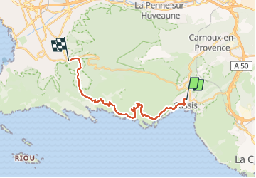

Length
20 km

Max alt
428 m

Uphill gradient
817 m
Km-Effort
31 km

Min alt
4 m

Downhill gradient
767 m
Boucle
No
Creation date :
2023-02-17 08:00:23.526
Updated on :
2023-02-17 14:41:27.837
6h40
Difficulty : Very difficult

FREE GPS app for hiking
 SityTrail
IGN / Geographical institutes
SityTrail Plus
The world is yours!
About
Trail Walking of 20 km to be discovered at Provence-Alpes-Côte d'Azur, Bouches-du-Rhône, Cassis. This trail is proposed by oliviergau.
Positioning
Country:
France
Region :
Provence-Alpes-Côte d'Azur
Department/Province :
Bouches-du-Rhône
Municipality :
Cassis
Location:
Unknown
Start:(Dec)
Start:(UTM)
706382 ; 4788142 (31T) N.
Comments