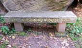
Le mur païen

VacheKiri67
User

Length
10.5 km

Max alt
831 m

Uphill gradient
298 m

Km-Effort
14.5 km

Min alt
590 m

Downhill gradient
284 m
Boucle
Yes
Creation date :
2014-12-10 00:00:00.0
Updated on :
2014-12-10 00:00:00.0
4h36
Difficulty : Medium

FREE GPS app for hiking
About
Trail Walking of 10.5 km to be discovered at Grand Est, Bas-Rhin, Ottrott. This trail is proposed by VacheKiri67.
Description
Faite le 20/10/2014 avec notre fils de 10 ans et nos amis Monique et Patrice, Francine et Christian et leur fils Marc, Claudine et sa fille Anne. D'après : TOPO GUIDE Au coeur de l'Alsace - N°2 Sainte-Odile : le mur "païen". La durée indiquée pour le circuit est de 3h30. Dans notre cas elle fut rallongée pour cause de cueillette de champignons.
Positioning
Country:
France
Region :
Grand Est
Department/Province :
Bas-Rhin
Municipality :
Ottrott
Location:
Unknown
Start:(Dec)
Start:(UTM)
381642 ; 5365675 (32U) N.
Comments


 SityTrail


Oups, la fenêtre s'est fermée avant que je donne la bonne note.
Merci VacheKiri pour ton circuit que je me suis permis de copier pour réaliser une magnifique rando.
Un lieu magique !