


Col des Deux Sœurs

GOHIER
User

Length
12.5 km

Max alt
2021 m

Uphill gradient
399 m
Km-Effort
19.6 km

Min alt
1149 m

Downhill gradient
930 m
Boucle
No
Creation date :
2023-02-18 09:32:30.0
Updated on :
2023-02-18 15:14:17.85
5h40
Difficulty : Medium

FREE GPS app for hiking
 SityTrail
IGN / Geographical institutes
SityTrail Plus
The world is yours!
About
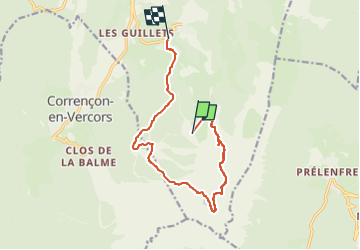
Trail Touring skiing of 12.5 km to be discovered at Auvergne-Rhône-Alpes, Isère, Villard-de-Lans. This trail is proposed by GOHIER.
Description
Par le vallon caché
Positioning
Country:
France
Region :
Auvergne-Rhône-Alpes
Department/Province :
Isère
Municipality :
Villard-de-Lans
Location:
Unknown
Start:(Dec)
Start:(UTM)
702133 ; 4989018 (31T) N.
Comments