


![Trail Walking Châtelblanc - [Jura] La Jaique - Photo](https://media.geolcdn.com/t/1900/400/ext.pjpeg?maxdim=2&url=https%3A%2F%2Fstatic1.geolcdn.com%2Fsiteimages%2Fupload%2Ffiles%2F1553511878bg_sport_marche.png)
[Jura] La Jaique

wawadefrance
User

Length
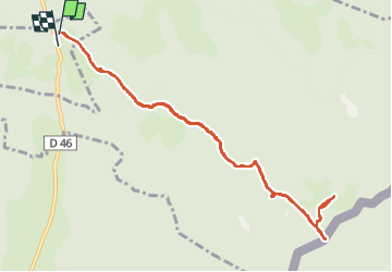
10.5 km

Max alt
1365 m

Uphill gradient
249 m
Km-Effort
13.9 km

Min alt
1135 m

Downhill gradient
257 m
Boucle
Yes
Creation date :
2023-02-21 09:46:42.256
Updated on :
2023-02-21 15:12:57.376
5h25
Difficulty : Difficult

FREE GPS app for hiking
 SityTrail
IGN / Geographical institutes
SityTrail Plus
The world is yours!
About
Trail Walking of 10.5 km to be discovered at Bourgogne-Franche-Comté, Doubs, Châtelblanc. This trail is proposed by wawadefrance.
Positioning
Country:
France
Region :
Bourgogne-Franche-Comté
Department/Province :
Doubs
Municipality :
Châtelblanc
Location:
Unknown
Start:(Dec)
Start:(UTM)
281230 ; 5169561 (32T) N.
Comments