


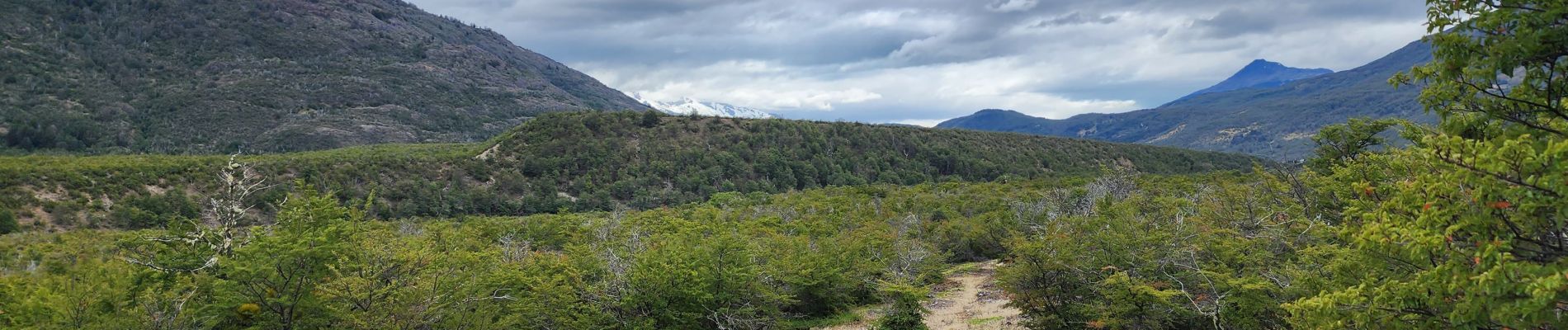
Confluencia ríos Baker y Neff

gildascb
User
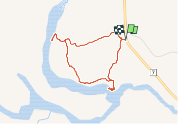

Length
4 km

Max alt
226 m

Uphill gradient
71 m
Km-Effort
4.9 km

Min alt
184 m

Downhill gradient
71 m
Boucle
Yes
Creation date :
2023-02-21 15:27:53.81
Updated on :
2023-02-21 16:52:14.124
1h24
Difficulty : Easy

FREE GPS app for hiking
 SityTrail
IGN / Geographical institutes
SityTrail World
The world is yours!
About
Trail Walking of 4 km to be discovered at Aysén Region, Provincia de Capitán Prat, Cochrane. This trail is proposed by gildascb.
Photos


Positioning
Country:
Chile
Region :
Aysén Region
Department/Province :
Provincia de Capitán Prat
Municipality :
Cochrane
Location:
Unknown
Start:(Dec)
Start:(UTM)
668908 ; 4779638 (18G) S.
Comments
Trails nearby