


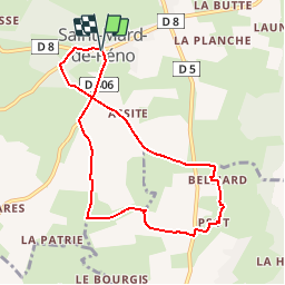

7.6 km | 9.3 km-effort


User


FREE GPS app for hiking
 SityTrail
IGN / Geographical institutes
SityTrail World
The world is yours!
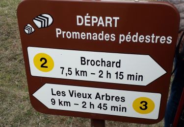
Trail Walking of 7.6 km to be discovered at Normandy, Orne, Saint-Mard-de-Réno. This trail is proposed by ODDAD78.
Circuit A

On foot
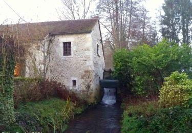
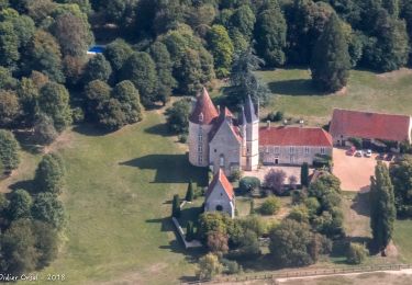
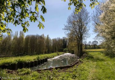
![Trail Walking La Chapelle-Montligeon - [Itinéraire] Le Mont Ligeon - Photo](https://media.geolcdn.com/t/375/260/ext.jpg?maxdim=2&url=https%3A%2F%2Fmedia.geolcdn.com%2Ff%2Fce92da88-fb92-411f-965d-5e4e270d0f79.jpeg)
Walking
Walking
Walking
Walking
Walking
Walking

Walking
Walking