


2023_02_22_Mielandre par Valouse

Chamois30
User
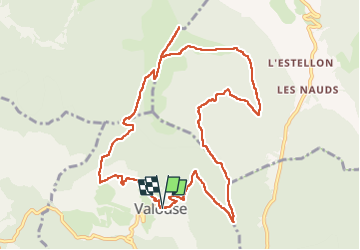

Length
12.3 km

Max alt
1443 m

Uphill gradient
923 m
Km-Effort
25 km

Min alt
706 m

Downhill gradient
933 m
Boucle
Yes
Creation date :
2023-02-22 08:40:36.412
Updated on :
2023-02-22 20:56:34.583
4h26
Difficulty : Difficult

FREE GPS app for hiking
 SityTrail
IGN / Geographical institutes
SityTrail Plus
The world is yours!
About
Trail Walking of 12.3 km to be discovered at Auvergne-Rhône-Alpes, Drôme, Valouse. This trail is proposed by Chamois30.
Positioning
Country:
France
Region :
Auvergne-Rhône-Alpes
Department/Province :
Drôme
Municipality :
Valouse
Location:
Unknown
Start:(Dec)
Start:(UTM)
674477 ; 4925585 (31T) N.
Comments