


Calmont

richardsimopons
User
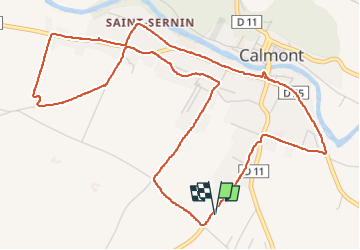

Length
7.2 km

Max alt
226 m

Uphill gradient
40 m
Km-Effort
7.8 km

Min alt
213 m

Downhill gradient
40 m
Boucle
Yes
Creation date :
2023-02-24 08:46:40.0
Updated on :
2023-02-24 10:45:22.778
1h49
Difficulty : Medium

FREE GPS app for hiking
 SityTrail
IGN / Geographical institutes
SityTrail Plus
The world is yours!
About
Trail Walking of 7.2 km to be discovered at Occitania, Haute-Garonne, Calmont. This trail is proposed by richardsimopons.
Description
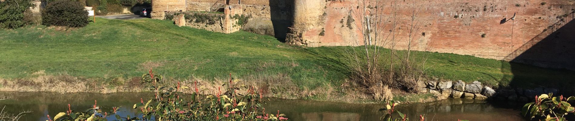
Le tour de Calmont: petite ville très agréable au bord de l’ Hers à 2 pas de l’ Ariège
Photos


Positioning
Country:
France
Region :
Occitania
Department/Province :
Haute-Garonne
Municipality :
Calmont
Location:
Unknown
Start:(Dec)
Start:(UTM)
388718 ; 4792495 (31T) N.
Comments