


Sentier des chevaux Cestayrol

chripaci
User
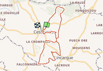

Length
9.7 km

Max alt
271 m

Uphill gradient
185 m
Km-Effort
12.1 km

Min alt
186 m

Downhill gradient
184 m
Boucle
Yes
Creation date :
2023-02-26 07:57:53.0
Updated on :
2023-02-26 14:55:42.724
2h13
Difficulty : Medium

FREE GPS app for hiking
 SityTrail
IGN / Geographical institutes
SityTrail Plus
The world is yours!
About
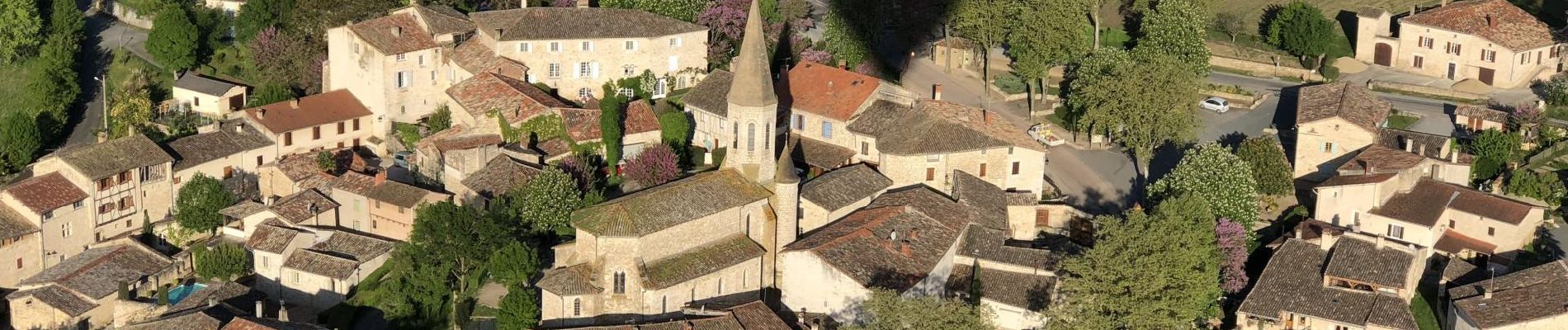
Trail Nordic walking of 9.7 km to be discovered at Occitania, Tarn, Cestayrols. This trail is proposed by chripaci.
Photos


Positioning
Country:
France
Region :
Occitania
Department/Province :
Tarn
Municipality :
Cestayrols
Location:
Unknown
Start:(Dec)
Start:(UTM)
418550 ; 4870264 (31T) N.
Comments
Mais quel est cet OVNI noir sur la photo ?