


Autour du mont st mard

pascha
User
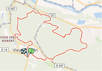

Length
12.5 km

Max alt
133 m

Uphill gradient
299 m
Km-Effort
16.5 km

Min alt
40 m

Downhill gradient
298 m
Boucle
Yes
Creation date :
2023-02-26 07:56:56.0
Updated on :
2023-02-26 11:15:08.004
3h17
Difficulty : Difficult

FREE GPS app for hiking
 SityTrail
IGN / Geographical institutes
SityTrail Plus
The world is yours!
About
Trail Walking of 12.5 km to be discovered at Hauts-de-France, Oise, Vieux-Moulin. This trail is proposed by pascha.
Positioning
Country:
France
Region :
Hauts-de-France
Department/Province :
Oise
Municipality :
Vieux-Moulin
Location:
Unknown
Start:(Dec)
Start:(UTM)
494996 ; 5470887 (31U) N.
Comments