


coseg 26 février

jcm17
User
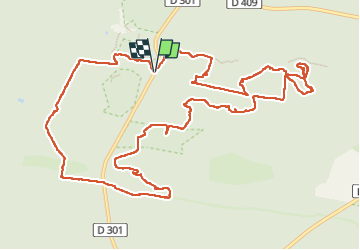

Length
14.3 km

Max alt
143 m

Uphill gradient
218 m
Km-Effort
17.2 km

Min alt
94 m

Downhill gradient
220 m
Boucle
Yes
Creation date :
2023-02-26 08:20:29.474
Updated on :
2023-03-01 17:55:32.001
5h49
Difficulty : Difficult

FREE GPS app for hiking
 SityTrail
IGN / Geographical institutes
SityTrail Plus
The world is yours!
About
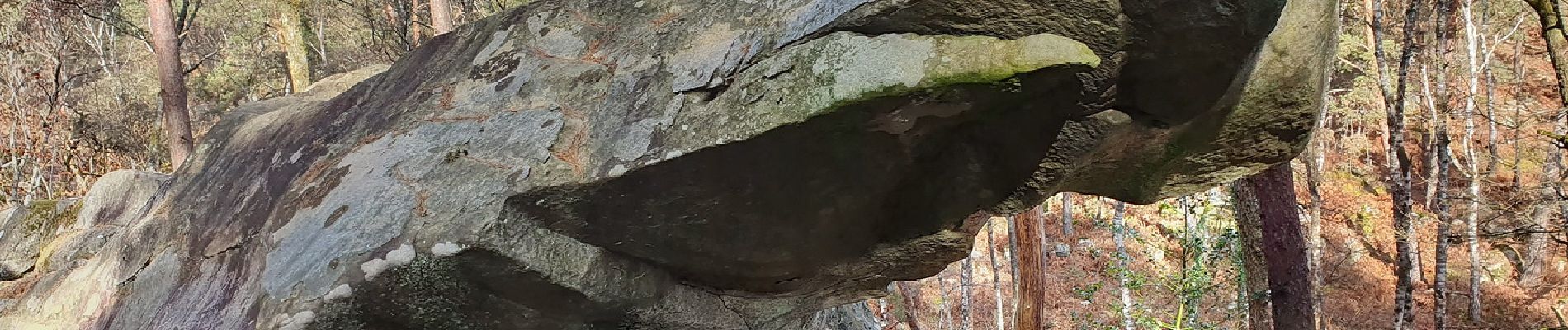
Trail Walking of 14.3 km to be discovered at Ile-de-France, Seine-et-Marne, Fontainebleau. This trail is proposed by jcm17.
Photos


Positioning
Country:
France
Region :
Ile-de-France
Department/Province :
Seine-et-Marne
Municipality :
Fontainebleau
Location:
Unknown
Start:(Dec)
Start:(UTM)
473223 ; 5361294 (31U) N.
Comments